
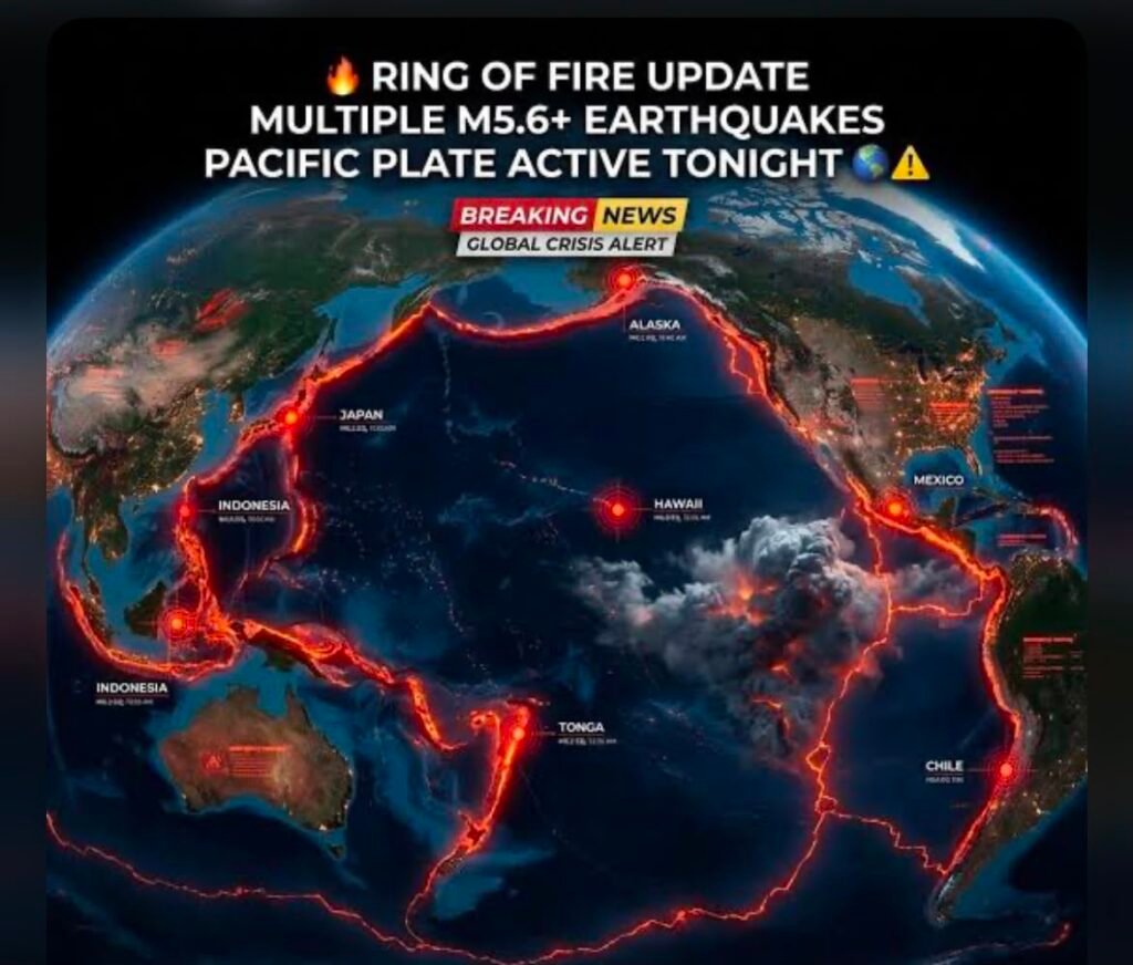
The Pacific Ring of Fire once again became the center of worldwide attention after reports indicated that six earthquakes struck different parts of the region within less than 24 hours. The events quickly spread across social media, leading many people to wonder whether the Earth is entering a period of increased seismic activity or whether a larger disaster could follow.
Although seeing multiple earthquakes occur within a short time may appear alarming, geologists explain that the Pacific Ring of Fire is naturally one of the most active seismic regions on the planet. Every year, thousands of earthquakes of different magnitudes occur along its boundaries because of continuous movement between massive tectonic plates beneath the Earth’s surface.
Understanding why these earthquakes happen, how scientists monitor them, and whether they are connected is essential for separating scientific facts from online speculation.
What Is the Pacific Ring of Fire?
The Pacific Ring of Fire is a horseshoe-shaped geological zone that surrounds much of the Pacific Ocean. It stretches for approximately 40,000 kilometers, passing through countries including Japan, Indonesia, the Philippines, Papua New Guinea, New Zealand, the west coast of North America, Central America, Chile, and Peru.
This region is famous because it contains around 75% of the world’s active volcanoes and experiences nearly 90% of the world’s earthquakes. The reason is simple, several large tectonic plates constantly collide, separate, or slide past one another, creating enormous geological pressure beneath the Earth’s crust.
: https://www.usgs.gov/programs/earthquake-hazards
Six Earthquakes Within 24 Hours: What Happened?
According to earthquake monitoring reports circulating online, several moderate earthquakes occurred across different parts of the Ring of Fire within a single day. Countries and regions mentioned included Japan, California in the United States, Papua New Guinea, the Philippines, and parts of South America.
Although these earthquakes occurred during a similar time frame, experts emphasize that this does not automatically mean they were directly connected. Most earthquakes occur because of local stress changes within individual fault systems rather than as part of one worldwide seismic event.
The United States Geological Survey (USGS) continuously records dozens of earthquakes every day around the globe, making multiple events in the Ring of Fire relatively common from a geological perspective.
Why Does the Ring of Fire Experience So Many Earthquakes?
The Earth’s outer shell is divided into enormous tectonic plates that slowly move across the planet’s surface. These plates travel only a few centimeters each year, but their movement generates tremendous pressure over time.
When that pressure exceeds the strength of surrounding rocks, the rocks suddenly break or slip, releasing stored energy as seismic waves. These waves are what people experience as earthquakes.
Different types of plate interactions occur throughout the Ring of Fire, including subduction zones where one plate sinks beneath another, transform boundaries where plates slide sideways, and divergent boundaries where plates move apart. Each type can generate earthquakes of varying sizes.
Because so many plate boundaries intersect around the Pacific Ocean, seismic activity remains consistently high throughout the region.
Were These Earthquakes Connected?
One of the biggest questions raised online is whether multiple earthquakes occurring within hours of each other indicate a chain reaction.
Current scientific evidence suggests that most earthquakes separated by thousands of kilometers are not directly linked. While one major earthquake can occasionally trigger aftershocks or nearby fault movement, there is very little evidence that an earthquake in Japan, for example, would immediately trigger another in South America across the Pacific Ocean.
Scientists evaluate each earthquake individually by studying its location, depth, magnitude, and fault mechanism before determining whether any relationship exists.
This careful scientific analysis helps avoid unnecessary panic caused by misleading online claims.
Can Scientists Predict Earthquakes?
Despite remarkable advances in earthquake monitoring technology, scientists cannot accurately predict the exact time, place, or magnitude of future earthquakes.
Modern seismic networks can detect earthquakes within seconds after they begin and provide valuable early warning systems in some countries. These systems may give people only a few seconds to seek safety before strong shaking arrives, but even those few seconds can save lives.
Researchers continue developing better monitoring technologies using satellite observations, artificial intelligence, GPS measurements, and deep underground sensors. However, no reliable scientific method currently exists for predicting earthquakes before they happen.
How Countries Along the Ring of Fire Prepare
Since earthquakes cannot be prevented, governments focus on reducing damage through preparation and resilient infrastructure.
Japan has become one of the world’s leading examples of earthquake preparedness. Strict building regulations, nationwide emergency drills, advanced early warning systems, and continuous public education have significantly reduced casualties during major earthquakes.
Similarly, the United States, New Zealand, Chile, and several Pacific nations continue investing in stronger construction standards, emergency response planning, public awareness campaigns, and scientific research to improve resilience against future disasters.
: https://www.ready.gov/earthquakes
Social Media and Earthquake Misinformation
Whenever multiple earthquakes occur within a short period, social media platforms often become flooded with dramatic headlines predicting catastrophic global events.
Many posts incorrectly claim that several earthquakes automatically signal an approaching “mega earthquake” or volcanic catastrophe. While these claims may attract attention, they rarely reflect scientific evidence.
Experts recommend relying on trusted organizations such as the United States Geological Survey (USGS), the National Oceanic and Atmospheric Administration (NOAA), and local geological agencies for verified information rather than viral social media posts.
Responsible reporting plays an important role in preventing unnecessary fear during natural events.
Conclusion
The reports of six earthquakes across the Pacific Ring of Fire within less than 24 hours understandably attracted worldwide attention. However, according to current geological understanding, the Ring of Fire is naturally the most seismically active region on Earth, making clusters of earthquakes relatively common.
While every earthquake deserves careful monitoring because of its potential impact on nearby communities, these events should be interpreted using scientific evidence rather than speculation. Continued investment in research, earthquake-resistant infrastructure, early warning systems, and public education remains the most effective way to reduce future risks.
As monitoring technology continues to improve, scientists will gain an even better understanding of Earth’s complex tectonic processes. Until then, staying informed through reliable scientific sources remains the best approach for anyone following developments across the Pacific Ring of Fire.


